
Archive

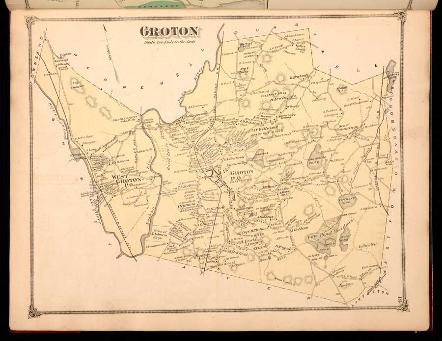
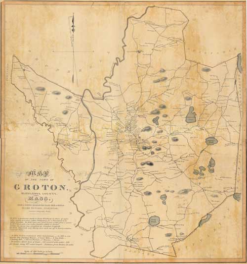
Henry Francis WallingHenry Francis Walling (June 11, 1825 – April 8, 1889) was one of the leading American surveyors, cartographers, and map publishers of the mid-nineteenth century. Born in Providence, Rhode Island, he studied and worked at the Providence Athenaeum before pursuing civil engineering and...

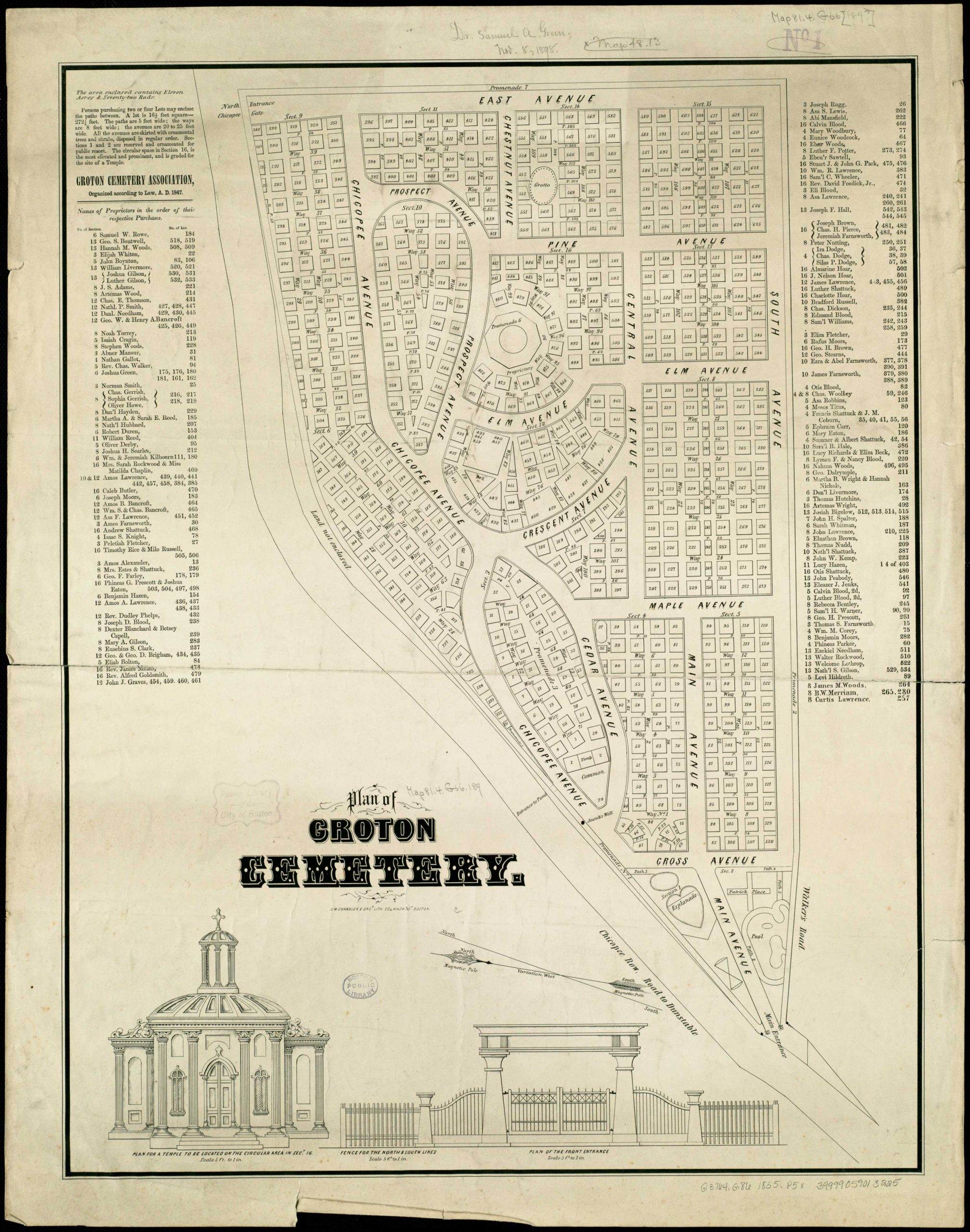
Map By Samuel Ward ChandlerSamuel Ward Chandler (July 12, 1803 – April 9, 1900) was a Boston engraver, lithographer, and publisher active during the mid-19th century. Born in Petersham, Massachusetts, he attended Leicester Academy before graduating from Harvard in 1822. After briefly studying law and...

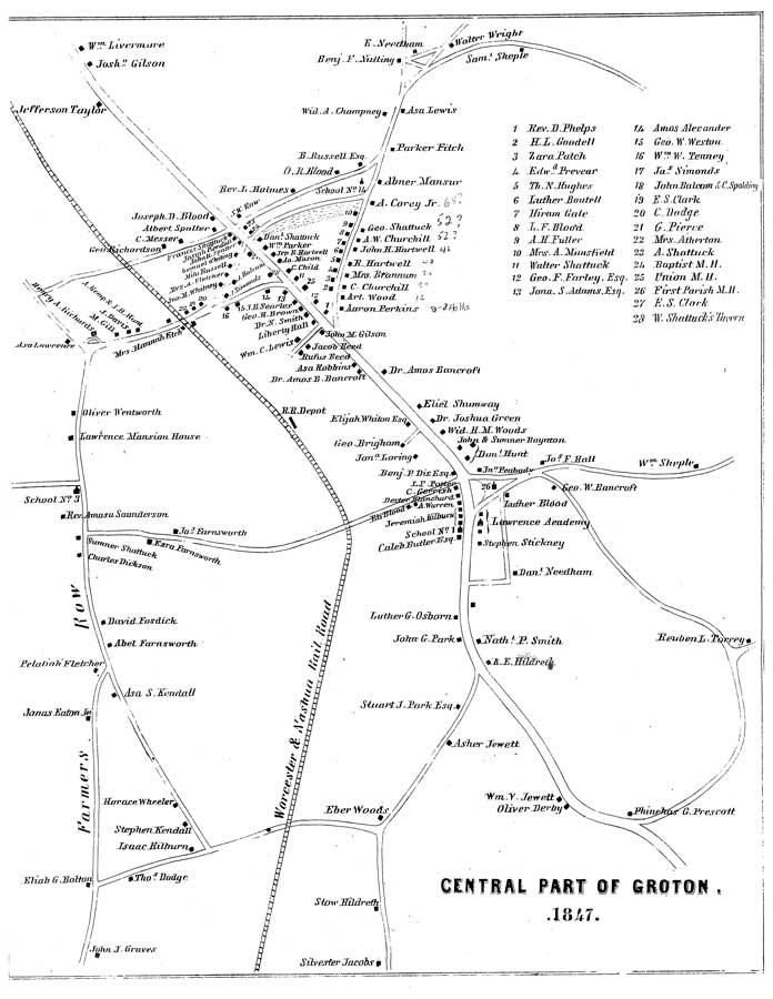
1847 Groton Maps by Caleb Butler Download High Resolution Map (PDF) Additional Information About This Map History of the Town of Groton by Caleb Butler, 1848, 546 pages. See page 248 for map source. (PDF 27mb) Additional Maps...

#gallery-1 { margin: auto; } #gallery-1 .gallery-item { float: left; margin-top: 10px; text-align: center; width: 100%; } #gallery-1 img { border: 2px solid #cfcfcf; } #gallery-1 .gallery-caption { margin-left: 0; } /* see gallery_shortcode() in wp-includes/media.php */ Download High Resolution Maps (PDF) Additional Maps...

Plans of Groton made by Caleb ButlerTo create a more accurate map of Massachusetts, the state legislature passed Resolves 1829, Chapter 50, requiring every town—and the City of Boston—to submit a detailed plan based on a survey completed within the previous five years. Drawn at...

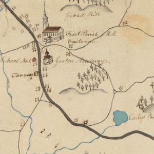
By Sanford Johnson “In conformity to a Resolve of the Legislature of said Commonwealth passed March 1st, A.D. 1830” *The Commonwealth of Massachusetts, in an effort to take stock of community resources in the form of mills, schools, geologic features, roads and other aspects of the...

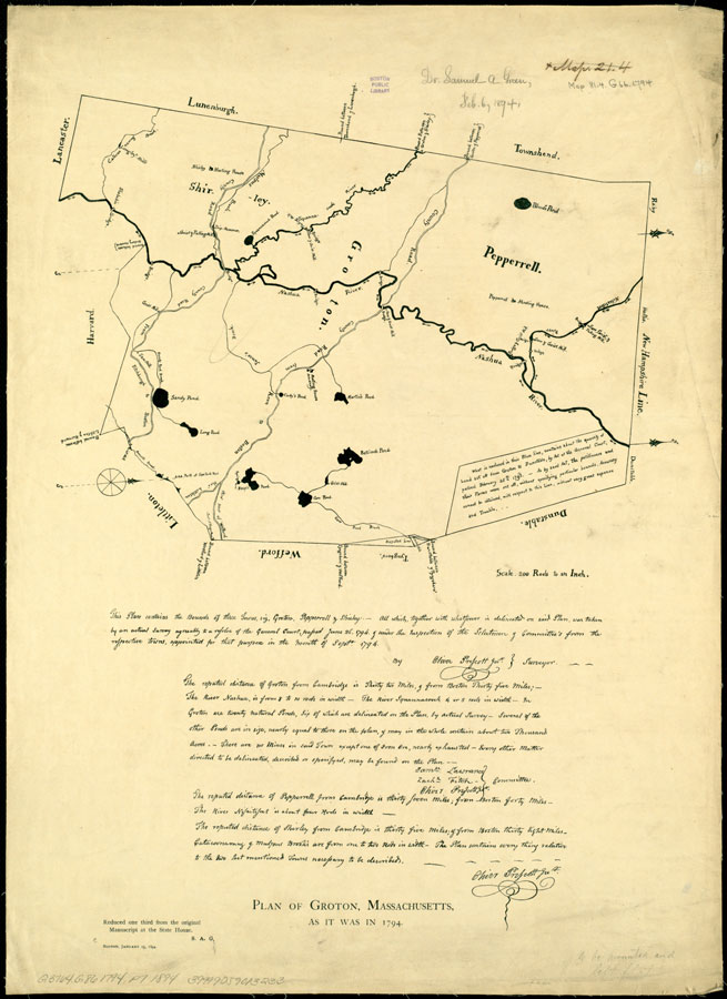
Plan of Groton, Pepperell and Shirley, made by Oliver Prescott, Jr., dated September, 1794. For the compilation of a state map, each town in Massachusetts (including those in the five eastern counties now part of Maine) was required by Resolves 1794, May Sess, c 101 (June...

A Map of New EnglandWoodcut31 cm x 39 cm[Boston: printed by John Foster, 1677]Originally published in William Hubbard's The Present State of New-England."Wine Hills" version.This early map of New England, probably by John Foster, was published in The Present State of New-England by William Hubbard...

#gallery-1 { margin: auto; } #gallery-1 .gallery-item { float: left; margin-top: 10px; text-align: center; width: 33%; } #gallery-1 img { border: 2px solid #cfcfcf; } #gallery-1 .gallery-caption { margin-left: 0; } /* see gallery_shortcode() in wp-includes/media.php */ 1668 Danforth plan (Re-drawn in 1826 by Caleb Butler, and in 1885 by Dr. Samuel Green)Map Notes(From pages 10-11 of Dr. Peter Green's "The...