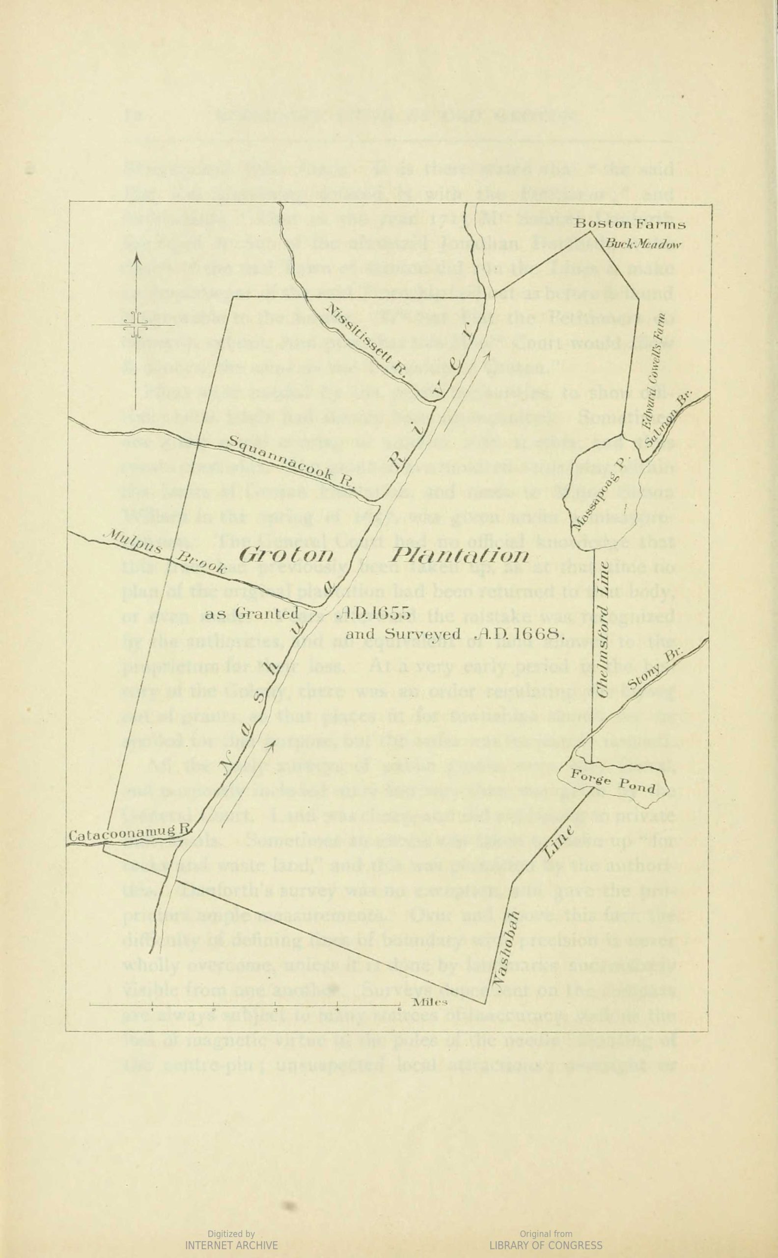
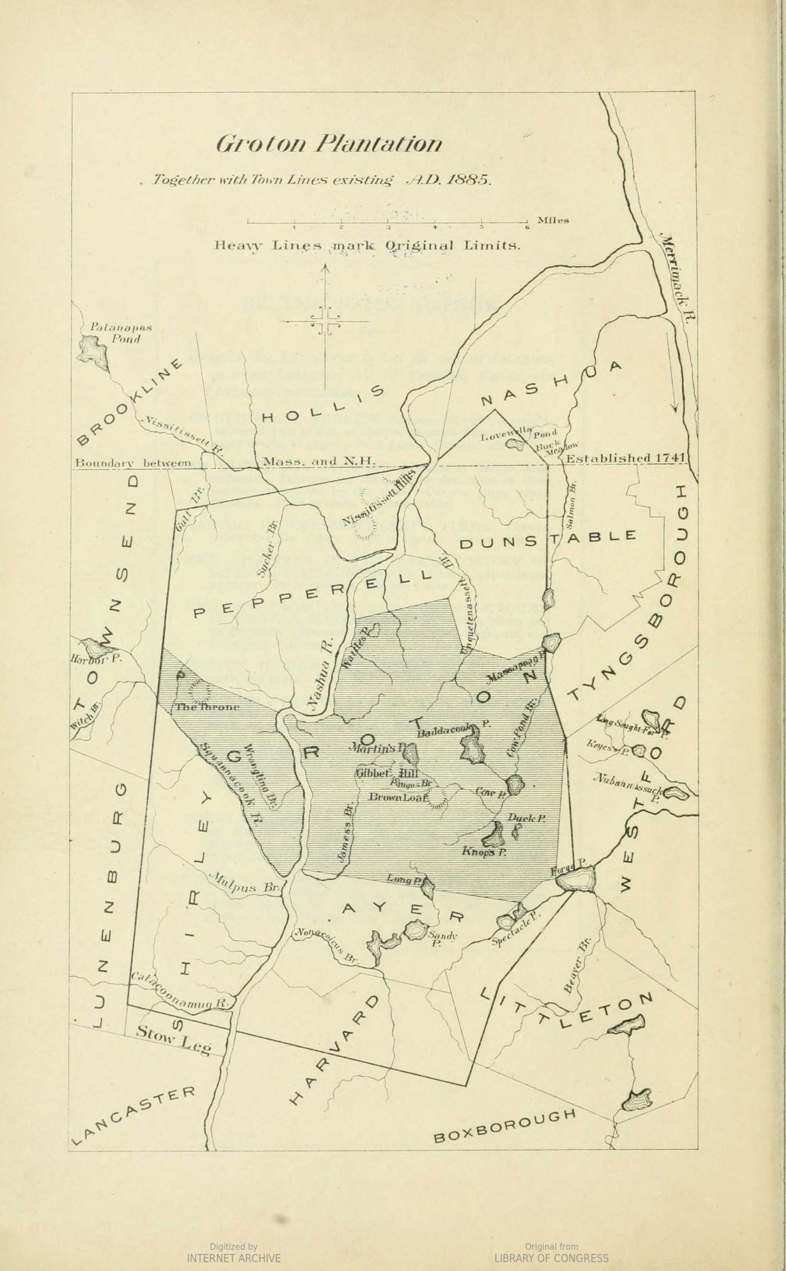
1668 Danforth plan (Re-drawn in 1826 by Caleb Butler, and in 1885 by Dr. Samuel Green)
Map Notes
(From pages 10-11 of Dr. Peter Green’s “The Boundary Lines of Old Groton) “Ensign Peter Noyes, of Sudbury, was then engaged by the grantees, and he began the survey; but his death, on September 23, 1657, delayed the speedy accomplishment of the work. It is known that there was some trouble in the early settlement of the place, growing out of the question of lands, but its exact character is not recorded; perhaps it was owing to the delay which now occurred.”
Ensign Noyes was a noted surveyor, but not so famous as Jonathan Danforth, whose name is often mentioned in the General Court records, in connection with the laying out of lands and towns, and many of whose plans are still preserved among the Archives in the State House. Danforth was the man wanted at first for the undertaking; and after Noyes’s death he took charge of it, and his elder brother, Thomas, was associated with him. The plat or plan of the land, however, does not appear to have been completed until April, 1668. The survey was made during the preceding year. At a meeting of the selectmen of the town, held on November 23, 1667, it is recorded that a rate should be levied in order to pay “the Artest and the men that attended him and his diet for himself and his horse, and for two sheets of parchment, for him to make two platts for the towne, and for Transportation of his pay all which amounts to about twenty pounds and to pay severall other town debts that appear to us to be due.”
(From pages 13 of Dr. Peter Green’s “The Boundary Lines of Old Groton) “While the original plan of Groton has been lost or destroyed, it is fortunate that many years ago a copy was made, which is still preserved. In June, 1826, the Honorable James Prescott was in the possession of the original, which Caleb Butler, Esq., at that time transcribed into one of the town record- books. Even with this clew a special search has been made for the missing document, but without success. If it is ever found it will be by chance, where it is the least looked for. There is no reason to doubt the accuracy of the outlines or the faithfulness of the copy. The relative distances between the streams emptying into the Nashua River, however, are not very exact; and in the illustration placed opposite, for the sake of clearness I have added their names, as well as the name of Forge Pond, formerly called Stony Brook Pond.”