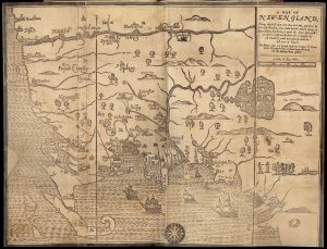
Woodcut 31 cm x 39 cm [Boston: printed by John Foster, 1677]
Originally published in William Hubbard’s The Present State of New-England. “Wine Hills” version.
Note that there were two versions of this map, one created shortly after the other, both oriented with north at the right edge. The “Wine Hills Version” was the initial effort by the engraver and is named after the erroneous label for the mountains in New Hampshire. The later version, the “White Hills Version” corrects this and other place names on the original. Distinctions between the two versions are small, however, and the primary interest for GHS members and readers is the presence of Groton on one of the country’s earliest maps and the earliest one printed on American soil. The finer points of the naming and re-creation process are explained in detail in Dr. Green’s remarks on “Hubbard’s Map of New England”, appended below.