
Mapping Groton, 1828-1832
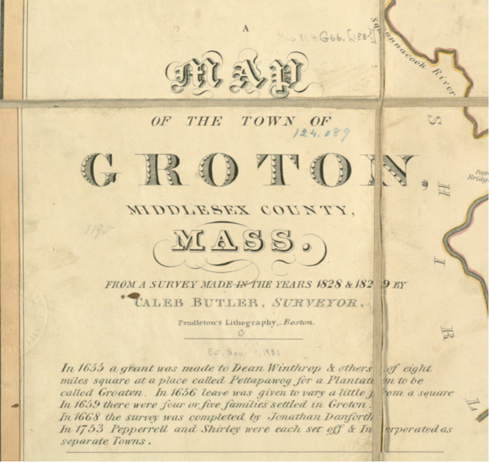
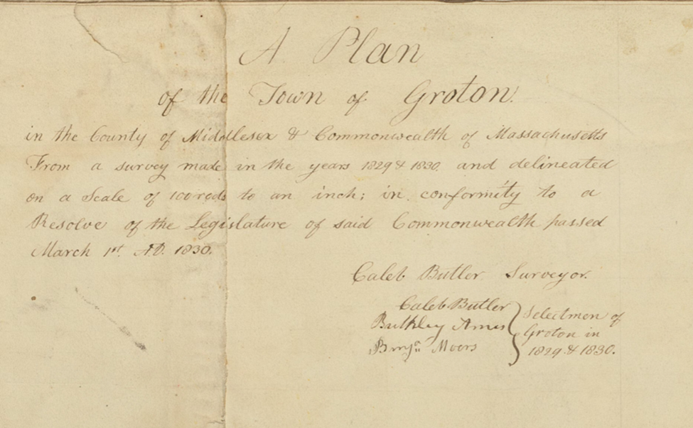
| By Sanford Johnson “In conformity to a Resolve of the Legislature of said Commonwealth passed March 1st, A.D. 1830” * The Commonwealth of Massachusetts, in an effort to take stock of community resources in the form of mills, schools, geologic features, roads and other aspects of the physical environment, and in order to create a more accurate map of the state at large, required all towns to complete a survey depicting boundaries and a prescribed list of features, all for submittal to the state secretary. The commonwealth specified what was to be included (See above and add: distance to shire town (Cambridge), public buildings and waterways), the scale (One hundred rods to the inch), and that the survey should be no more than five years old. State authorities had done this once before, in 1794, at a time when the commonwealth included land in what is now Maine. Groton is fortunate to have been included in both efforts to locate municipal boundaries and resources, but in the case of the 1830 effort, the town benefits far more than other towns from the diligence and record keeping of its surveyor/cartographer (as well as headmaster, historian, civil servant – the list goes on), Caleb Butler. Butler ended up compiling two maps from the survey he carried out in 1829 &1830 (Or 1828 & 1829 - in a rare misstep, he contradicts himself in the two map headings). He made one map (Engraved by Pendleton’s Lithography in Boston – a well-known concern that merits its own research)** using black ink with subtle coloring at the boundary lines that is in accordance with most of the other town plans from the series and includes additional detail not shown on other town maps such as when certain streets were laid out (Including one labelled “Laid out in 1832” – some time after the survey) and many owner names. These aspects are invaluable to historians. On the second map***, he depicts forest land and employs more color. While they are clearly drawn from the same survey and share many features, the headings or titles are distinct and each map contains information that does not appear on the other. Both versions are professional in the extreme, rendered in clear dark lines with some shaded areas for effect and even some artistic flourishes. Note that certain artistic features of the Pendleton version of Butler’s map, such as the elaborate title and the north arrow, were likely created by lithographers in the Boston shop given those features’ similarity to at least nine other town maps from the 1830 series created by them. These maps are merely the end products created from Butler’s survey notes, however, and do not speak to the process of how they came to be. The modern theory for how the work was carried out is that he travelled every road in the town on a horse drawn wagon, probably with an assistant or two, carrying a compass to determine direction, all the while counting revolutions of a wagon wheel (Travelling a known distance with each turn) with benefit of a flag tied to a spoke. This determined the bearing and length of travel along roadways. Upon traversing a residence in the wagon, he would enter the direction of travel, distance in rods from the previous feature or house, owner name, number of stories and number of bays (Windows across the facade) into a matrix. A very interesting column of information in the notes is the one containing house colors which gives us a more vivid notion of the scene – many houses were not just painted white as some would suppose for that time. Butler also adds to the notes some commentary, such as when he refers to an area in the northwest of the town as “Miserably poor”, or one that contained “Many Irish” or that some houses were “Old” which we may take to mean “Dilapidated”. This Federal Period example of a town-wide list of house descriptions including paint colors is probably unique. Groton repays the historian’s efforts far more than other towns its size because of people like Caleb Butler, of whom the town had many, and who provided succeeding generations with much to consider in the form of these maps (as well as similar ones for Pepperell and Shirley) and his history of the town (Written well prior to those in surrounding towns) all while living a full and exemplary life of many distinct accomplishments. * The date here is from Butler’s title on the second map. The website Digital Commonwealth, a statewide consortium of libraries, museums, archives, and historical societies from across Massachusetts, indicates the survey was required by the Resolves of 1829, c 50. **Version 1 ***Version 2 Both are collected here |
 Detail of Plan of Groton |
Title, Version 1 “Map of the Town of Groton, Middlesex County, Mass.” (Title was Likely drawn by employees at Pendleton’s Lithography)
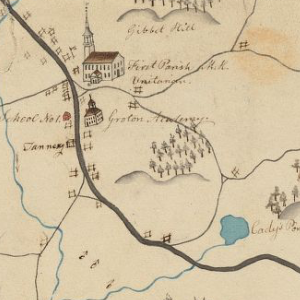
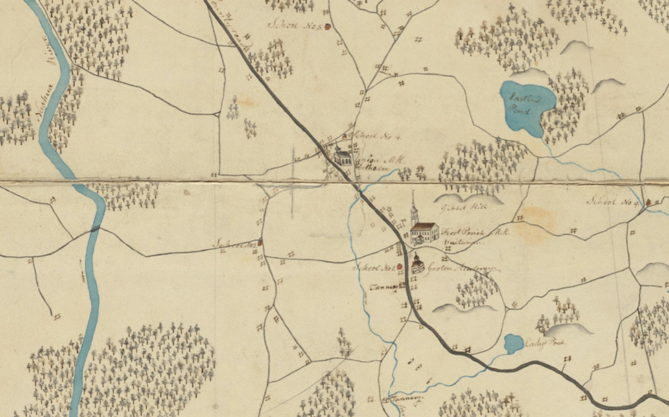
Town Center
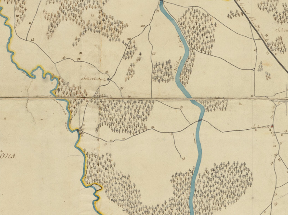
West Groton
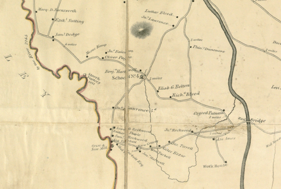
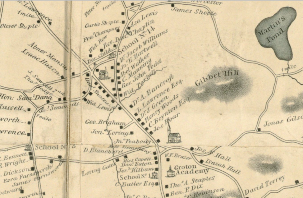
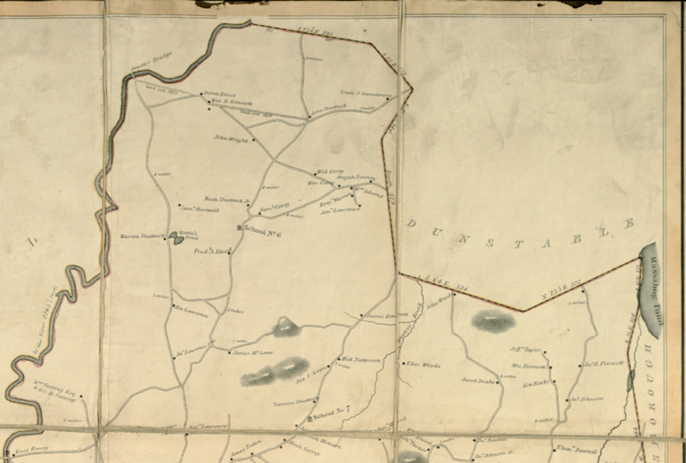
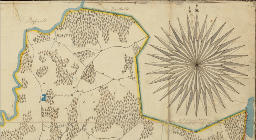
North Groton and Pepperell
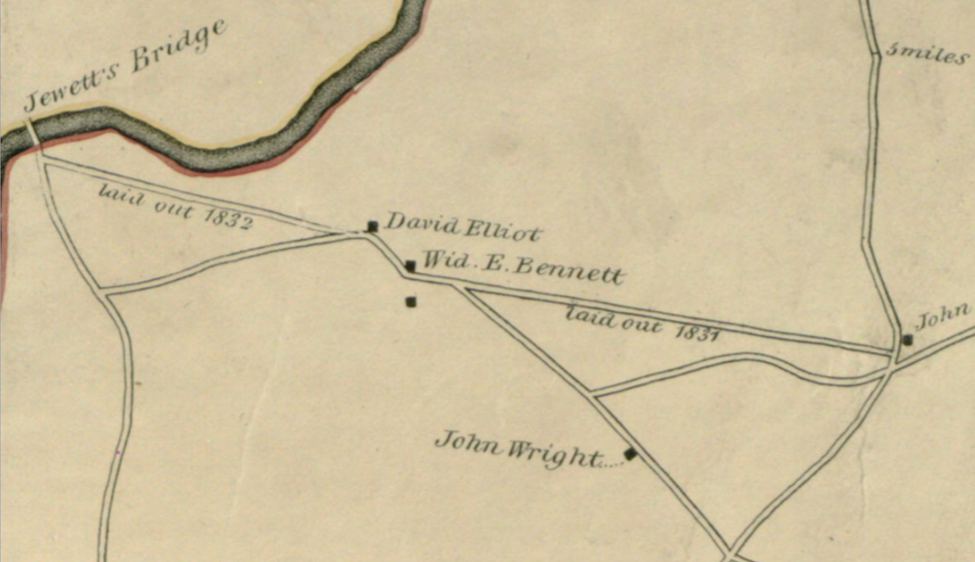
North Groton (now a part of Pepperell) – Detail
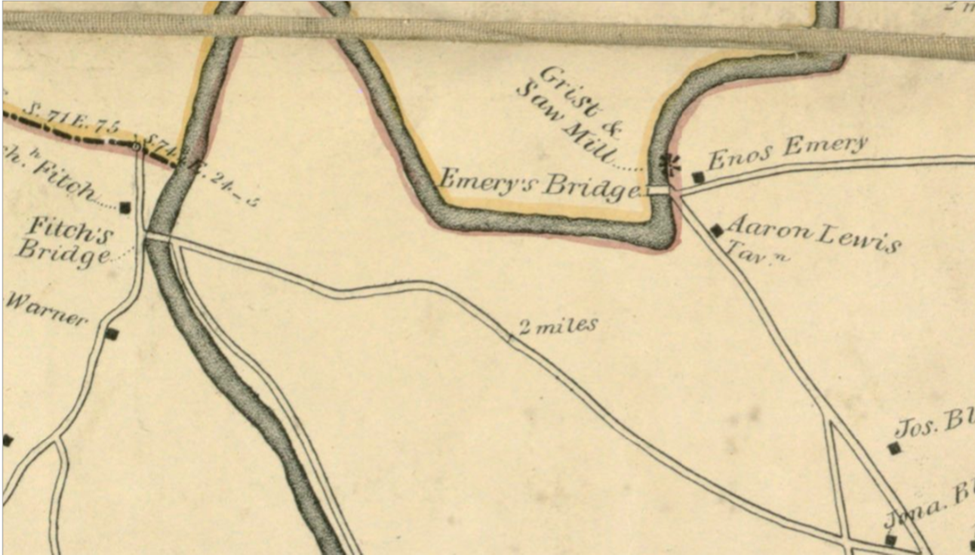
Fitch’s Bridge – Main Street and Nod Road
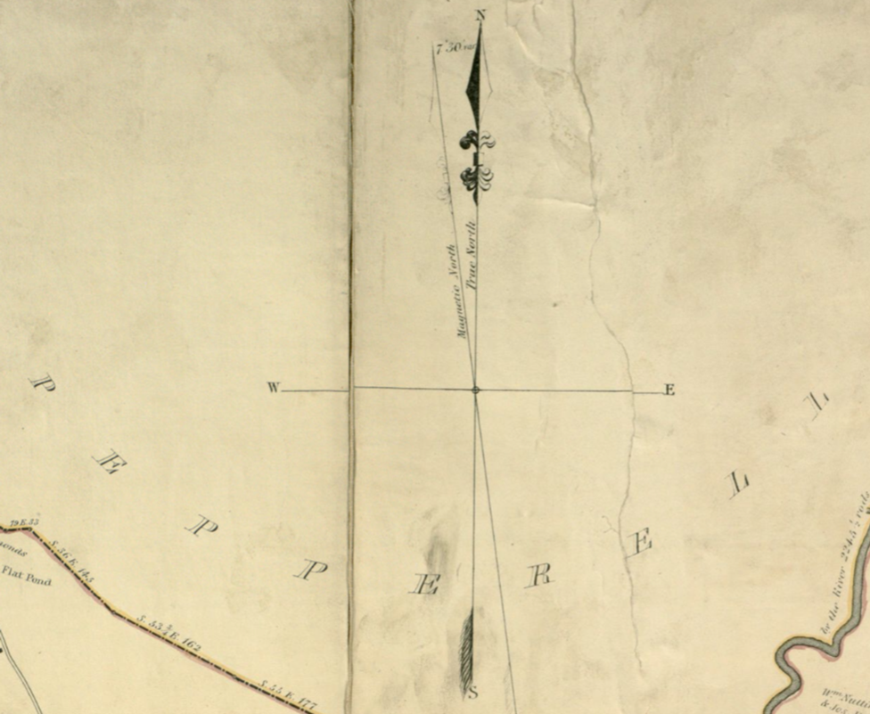
North Arrow – Probably drawn by Pendelton’s Lithographers
Title – Version 2 “A Plan of the Town of Groton.”
Town Center
West Groton
North Groton and Pepperell with Compass Rose
posted 02/06/2026